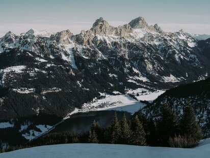
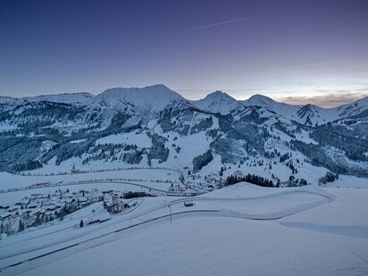
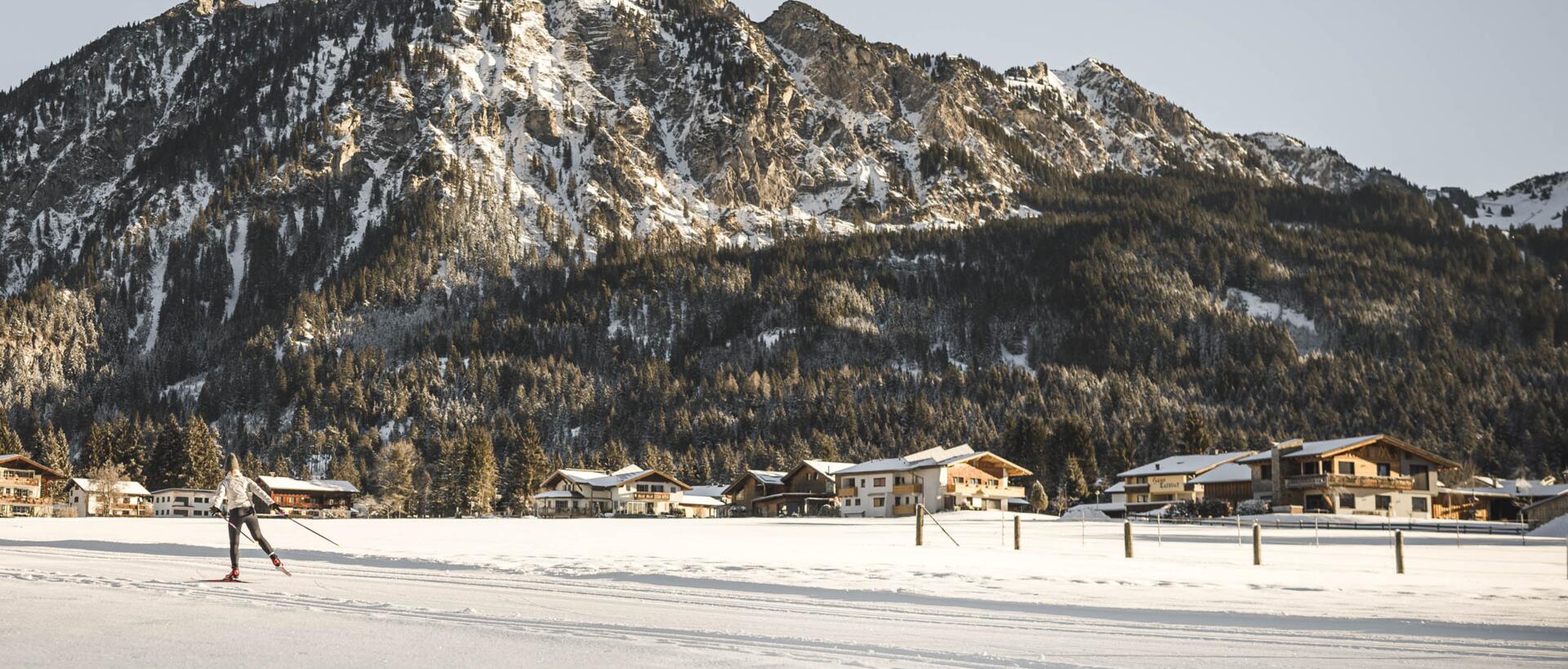
The best way to describe people from the Tannheim Valley? Rooted in the Tyrol, but looking out over the mountains into the wider world. ; )
holidays in the Tannheim valley
Was auf Google Maps & Wikipedia
über das Tannheimer Tal zu lesen ist
Just to clear up any confusion, the Tannheim Valley is part of the Tyrol and is therefore in Austria! The reason we need to explain? Lots of people are not quite sure, because we are close to the German border and there is actually one bit of the Tyrol (Jungholz) which is totally surrounded by Germany – yet still part of Austria. But we will tell you more about that a little further down. Another reason for the geographical confusion is the fact that the Tammheim Valley lies in the Allgäu Alps – and Allgäu, as many of you will know, is part of Germany. But the Allgäu Alps themselves are partly in Germany and partly, you guessed it, in Austria. Confused? You should be! But the most important thing to remember after all that is: Der Engel = Grän = Tannheim Valley = Austria.
Finally, this location issue is settled once and for all, right? Sure, it may take less time to travel from our hotel to Kempten in Germany than to Innsbruck in Austria (the regional capital of the Tyrol), but the fact is we are Austrian. And while we've got you, we would also like to mention that the Tannheim Valley is often called the most beautiful high valley in Europe. Since we haven't yet been to every high valley in Europe, we can't verify this 100%, but it sounds pretty good for advertising purposes, doesn't it? In 2019 our region was also voted the most beautiful hiking destination in the whole of Austria by the readers of the German hiking magazine "Wandermagazin" – and not for the first time. But such surveys are two a penny and it all depends on which criteria they use, I suppose. Anyway, we reckon the best way to really find out is by coming here and seeing for yourself. We look forward to welcoming you!
Frequently asked questions über das Tannheimer Tal
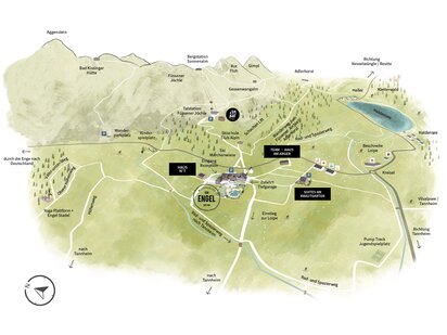
Don't tell me you've just skipped the first two paragraphs on this page?! We thought we had cleared up all the confusion about our location! Anyway, here is the short version: the Tannheim Valley lies in the district of Reutte, which is part of the Austrian province of Tyrol. There are three ways to access the valley: from the east coming from the Lech Valley over the Gaicht Pass, from the west coming from Bavaria via the Oberjochpass, and from the north coming from Pfronten (Bavaria) via the Engetal Valley.
- Grän - Haldensee
- Tannheim
- Nesselwängle - Haller
- Zöblen
- Schattwald
- Jungholz
- Vilsalpsee
- Traualpsee
- Haldensee
- Höfersee
- Floschen
For us, the following five hikes are among the most beautiful not only in the valley but in the whole of the Tyrol.
- Gappenfeldalpe Details of the hike
- Bad Kissinger Hütte Details of the hike
- Edenbachalpe Details of the hike
- Schneetalalm Details of the hike
- Gräner ÖdenalpeDetails of the hike
As locals who have grown up in Grän, we cannot give an objective or qualified answer to this question. We would, of course, say that the most beautiful place in the Tannheimer Tal is Grän ;-). But the people living in Tannheim will probably say that Tannheim is the most beautiful place in the valley.
If you visit Google it will show you what it thinks are the best photo points in the valley, but we have our own selection down below. These spots are, you guessed it, particularly instagrammable. But we would also encourage you to put away your phone for a few minutes and simply enjoy the landscape. Your followers can wait a few more minutes. ; )
- Vilsalpsee lakeGo to photo point
- Bergacht waterfallGo to photo point
- Cross-border hiking trail (try stage 2 to the Kirchendachsattel) Go to photo point
- Gipfelbuch Tannheim Go to photo point
- Zugspitze mountain Go to photo point
- Höfer See lake in Tannheim Go to photo point
- Floschen lake in Schattwald Go to photo point
The 6 villages in the Tannheim valley
Grän - Haldensee
Our little piece of paradise between Heaven & Earth. That is where we call home. Der Engel is located in Grän, a village in the heart of the Tannheim Valley with around 600 inhabitants. Here in the Tyrol there is often a strong rivalry between the villages in each valley – everyone believes theirs is the best and most beautiful. We are no different, so here is our case for why Grän is the number one spot in the Tannheim Valley – or indeed the whole of the Tyrol.
Where does the name Grän come from?
Perhaps you are wondering how the name of our village came about. "Gerüne" (meaning "windthrow" or "fallen trees") is the Middle High German word which forms the source of our village name Grän. It is known that quite a lot of trees in Grän were felled by the wind, hence the name.
What does the local coat of arms look like?
The origin of the name Grän means it is no surprise that our coat of arms contains a tree stump. The chamois on our coat of arms has a special meaning. In Grän it used to be the case that even commoners were allowed to hunt chamoix, a right which at that time was normally reserved for members of the aristocracy.
Apart from the hiking and biking trails, the 1.5 km Haldensee lake is particularly popular with guests holidaying in the Tannheim Valley in summer. Those who are into watersports can enjoy windsurfing, rowing, kayaking and stand-up paddle boarding on the lake. There is also a swimming area. In winter the Sonnberg cable cars take skiers to the 9 km of pistes at the foot of the Füssener Jöchle mountain. There are also 140 kilometres of cross-country skiing trails in the valley, which have become something of a well-kept secret in cross-country skiing circles. More details on the valley can be found below.
Tannheim
Tannheim is the largest village by population (around 1,100 inhabitants) and also the largest village by size in the valley. It has a number of cultural attractions:
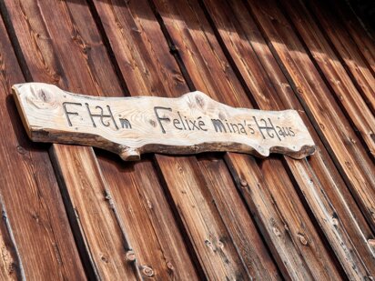
- Felixe Minas Haus
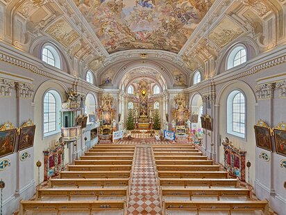
- Saint Nikolaus church
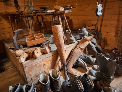
- Local history museum
- Vilsalpsee lake
- Höfersee lake
As if that were not enough, Tannheim has a small skiing area which is connected to the Zöblen-Schattwald skiing area. Both resorts can be accessed using a single ski pass. Like every village in the valley, Tannheim is also connected to the 140km network of cross-country skiing trails.
Nesselwängle-Haller
Approaching over the Gaichtpass, Nesselwängle with its settlements of Haller and Rauth is the first village you will reach in the Tannheim Valley. The village is bordered to the north by the Haldensee lake This small community with about 450 inhabitants nevertheless has a lot to offer guests. With 15.5 km of pistes, a 3.6 km toboggan run and a small snow park, the ski area is the second largest in the Tannheim Valley. There are also good cross-country ski trails as well as fine spas and good food. The hamlet of Haller lies on the shores of the Haldensee lake and offers guests direct access to the water. The forest adventure climbing park is popular with families and forms part of our children's activity programme here at Der Engel.
Zöblen
Home to around 250 people, Zöblen is the smallest village in the Tannheim Valley. Tourism is always low-key here and the village has managed to preserve its natural charm. Thanks to the merger of the Zöblen and Schattwald ski areas, guests can also enjoy 15km of pistes in this small village. Zöblen is also a good starting point for hikes and mountain bike rides in the valley.
Schattwald
Schattwald lies in the west of the Tannheim Valley, on the border with Bavaria, and has a population of around 450. The connection of the Schattwald and Zöblen ski areas has created the largest interconnected network of pistes in the Tannheim Valley. In winter, you can whizz across the entire valley floor on cross-country skis, and in summer you can follow in the footsteps of smugglers from centuries past. Another insider tip in summer are the sunrise rides on the Wannenjochbahn cable car. The ride up into the mountains is followed by a short walk to the top of the Wannenjoch, a peak on the border ridge between Germany and Austria. Where else can you see the sun rise in two countries at the same time?
Jungholz
Jungholz is one of two Tyrolean enclaves on German territory (the other is Kleinwalsertal, in case you were wondering). This means it is a part of Austria almost completely surrounded by Germany. Only at one point near the Sorgschrofen peak is Jungholz connected to the Tyrol. This means the only way to get there is by passing through Germany. But how did this curious situation come about? In 1342, Jungholz became part of Austria following a private purchase agreement between a man from Bavaria and a man from Tyrol. The result the unusual geographic situation described above, including a few more curious elements:
- Jungholz has both an Austrian and a German postal code.
- Banks in Jungholz are bound by the strict Austrian laws on banking secrecy, which is why many Germany citizens choose to keep their money here.
- 50% of the 300 people living in Jungholz are Austrians, while the other 50% are German citizens.
- Although Jungholz is in Austria, it is subject to German Value Added Tax.
Jungholz has 10 kilometres of ski pistes. And when the snow melts, the flowers come into bloom in what has been named the most beautiful herb village in Tyrol.
Our little piece of paradise between Heaven & Earth. That is where we call home. Der Engel is located in Grän, a village in the heart of the Tannheim Valley with around 600 inhabitants. Here in the Tyrol there is often a strong rivalry between the villages in each valley – everyone believes theirs is the best and most beautiful. We are no different, so here is our case for why Grän is the number one spot in the Tannheim Valley – or indeed the whole of the Tyrol.
Where does the name Grän come from?
Perhaps you are wondering how the name of our village came about. "Gerüne" (meaning "windthrow" or "fallen trees") is the Middle High German word which forms the source of our village name Grän. It is known that quite a lot of trees in Grän were felled by the wind, hence the name.
What does the local coat of arms look like?
The origin of the name Grän means it is no surprise that our coat of arms contains a tree stump. The chamois on our coat of arms has a special meaning. In Grän it used to be the case that even commoners were allowed to hunt chamoix, a right which at that time was normally reserved for members of the aristocracy.
Apart from the hiking and biking trails, the 1.5 km Haldensee lake is particularly popular with guests holidaying in the Tannheim Valley in summer. Those who are into watersports can enjoy windsurfing, rowing, kayaking and stand-up paddle boarding on the lake. There is also a swimming area. In winter the Sonnberg cable cars take skiers to the 9 km of pistes at the foot of the Füssener Jöchle mountain. There are also 140 kilometres of cross-country skiing trails in the valley, which have become something of a well-kept secret in cross-country skiing circles. More details on the valley can be found below.
Tannheim is the largest village by population (around 1,100 inhabitants) and also the largest village by size in the valley. It has a number of cultural attractions:
- Felixe Minas Haus
- Saint Nikolaus church
- Local history museum
- Vilsalpsee lake
- Höfersee lake
As if that were not enough, Tannheim has a small skiing area which is connected to the Zöblen-Schattwald skiing area. Both resorts can be accessed using a single ski pass. Like every village in the valley, Tannheim is also connected to the 140km network of cross-country skiing trails.
Approaching over the Gaichtpass, Nesselwängle with its settlements of Haller and Rauth is the first village you will reach in the Tannheim Valley. The village is bordered to the north by the Haldensee lake This small community with about 450 inhabitants nevertheless has a lot to offer guests. With 15.5 km of pistes, a 3.6 km toboggan run and a small snow park, the ski area is the second largest in the Tannheim Valley. There are also good cross-country ski trails as well as fine spas and good food. The hamlet of Haller lies on the shores of the Haldensee lake and offers guests direct access to the water. The forest adventure climbing park is popular with families and forms part of our children's activity programme here at Der Engel.
Home to around 250 people, Zöblen is the smallest village in the Tannheim Valley. Tourism is always low-key here and the village has managed to preserve its natural charm. Thanks to the merger of the Zöblen and Schattwald ski areas, guests can also enjoy 15km of pistes in this small village. Zöblen is also a good starting point for hikes and mountain bike rides in the valley.
Schattwald lies in the west of the Tannheim Valley, on the border with Bavaria, and has a population of around 450. The connection of the Schattwald and Zöblen ski areas has created the largest interconnected network of pistes in the Tannheim Valley. In winter, you can whizz across the entire valley floor on cross-country skis, and in summer you can follow in the footsteps of smugglers from centuries past. Another insider tip in summer are the sunrise rides on the Wannenjochbahn cable car. The ride up into the mountains is followed by a short walk to the top of the Wannenjoch, a peak on the border ridge between Germany and Austria. Where else can you see the sun rise in two countries at the same time?
Jungholz is one of two Tyrolean enclaves on German territory (the other is Kleinwalsertal, in case you were wondering). This means it is a part of Austria almost completely surrounded by Germany. Only at one point near the Sorgschrofen peak is Jungholz connected to the Tyrol. This means the only way to get there is by passing through Germany. But how did this curious situation come about? In 1342, Jungholz became part of Austria following a private purchase agreement between a man from Bavaria and a man from Tyrol. The result the unusual geographic situation described above, including a few more curious elements:
- Jungholz has both an Austrian and a German postal code.
- Banks in Jungholz are bound by the strict Austrian laws on banking secrecy, which is why many Germany citizens choose to keep their money here.
- 50% of the 300 people living in Jungholz are Austrians, while the other 50% are German citizens.
- Although Jungholz is in Austria, it is subject to German Value Added Tax.
Jungholz has 10 kilometres of ski pistes. And when the snow melts, the flowers come into bloom in what has been named the most beautiful herb village in Tyrol.
December 2025, January & March 2026
Not with us!
From 15. - 18. December 2025 (only in Grän - Füssener Jöchle), from 12. - 15. January 2026 , from 19. - 22. January 2026, from 26. - 29. January 2026 and from 09. - 12. March2026 you can ski in the participating ski areas in the Tannheimer Tal - for FREE! As always and everywhere there are conditions ; ). The "free" lift ticket is valid from Monday to Thursday and you get it from a stay of at least three nights. In Tannheim and Grän, winter hikers are also transported for free with this ticket. At the Schattwald and Zöblen ski lifts, this offer is only valid for skiers and snowboarders (no winter hikers).
ACTIVITIES FOR YOUR HOLIDAY IN THE TANNHEIMER VALLEY
Skiing
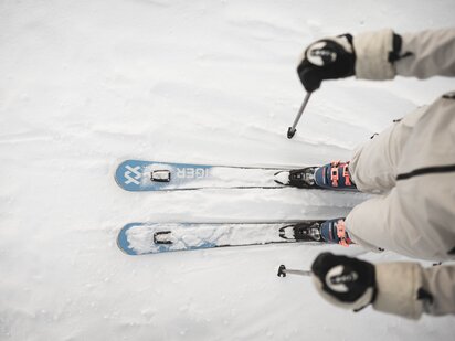
THE national sport in the Tyrol. There are 6 villages in the Tannheim Valley and each is connected to a ski area. The valley has a total of 50 km of pistes and 15 lifts. 1 joint ski pass for the villages of Grän, Tannheim, Schattwald/Zöblen. There is something for everyone, from blue to black runs, practice areas to race courses.
Engel Service: Discounts on equipment hire, ski courses and snowboard courses at the Skischule Club Alpin.
More info
Cross-country skiing
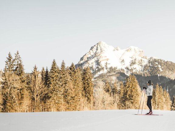
140 km cross-country ski trail network with connections to 5/6 villages in the Tannheim Valley (except Jungholz). Trails for both the traditional Classic technique and the more modern and dynamic Skating technique. Everything from easy cruising to tough climbs. Awarded the cross-country skiing seal of quality by the local authorities.
Engel Service: Discounts on equipment hire, ski courses and snowboard courses at the Skischule Club Alpin.
Snowshoeing & winter walking
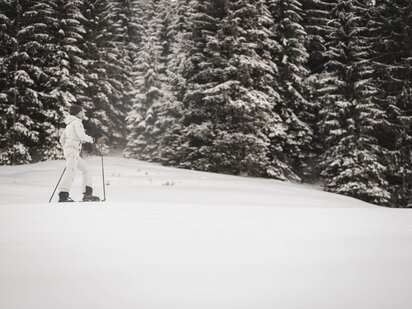
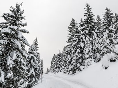
81 km of well-maintained hiking trails and 16 different routes. Down in the valley and up in the mountains. With snowshoes or hiking boots. Together in a group or alone through the snow-covered forests and meadows.
Engel Service: Discounts on equipment hire. Guided winter walks and snowshoe adventures in our weekly programme.
Hiking &
climbing
Named Austria's most popular hiking destination. 300 km of hiking trails and 31 huts. 4 lifts and cable cars, which can be used once a day free of charge in summer. 3 via ferrata climbing routes, 1 climbing forest (adventure park for children) and over 100 rock climbing routes rated from 3 (easy) to 10 (super hard).
Engel Service: Guests are welcome to borrow a hiking rucksack and hiking map. We also offer several guided walks and hikes per week.
Road bike &
mountain bike
22 road bike rides totalling around 2,500 km. An organised cycling event through the entire Tannheim Valley. Special training weeks for road bike riders. 15 official mountain bike routes totalling 150 km. Various bike rental stations.
Engel Service: We have e-bikes, mountain bikes and cycling maps for hire. We also offer several guided bike rides per week.
Jogging &
trailrunning
26 designated jogging and trailrunning routes totalling 186 km. Trails with up to 1,500 vertical metres of uphill and 30 km of distance from start to finish. Intensive trailrunning training during the Tannnheim Trail Days. Event for trailrunning beginners and advanced runners: Lakes Run in the Tannheim Valley.
Engel Service: We have Nordic walking poles available for hire and offer several Nordic walking sessions as part of our weekly activity programme.
Vilsalpsee lake
The nature and bird reserve around the Vilsalpsee lake is known for its rich flora and fauna. In order to preserve this wealth of biodiversity the access road is closed to cars daily from 08:00 to 17:00. During this time you can reach the lake using the Alpine Express shuttle, by bus, by horse-drawn carriage or on foot. If you hike along the shore of the Vilsalpsee to the Vilalpsee Alpe you have the option of completing a circular hike through unspoilt nature leading past the Bergacht waterfall. A great spot for an Instagram, we think. The hike past the Vilsalpsee lake up to the Traualpsee lake is also a beautiful one.


